Thanks for spreading the nice!
T
h
a
n
k
s
f
o
r
s
p
r
e
a
d
i
n
g
t
h
e
n
i
c
e
!
Skip to product information

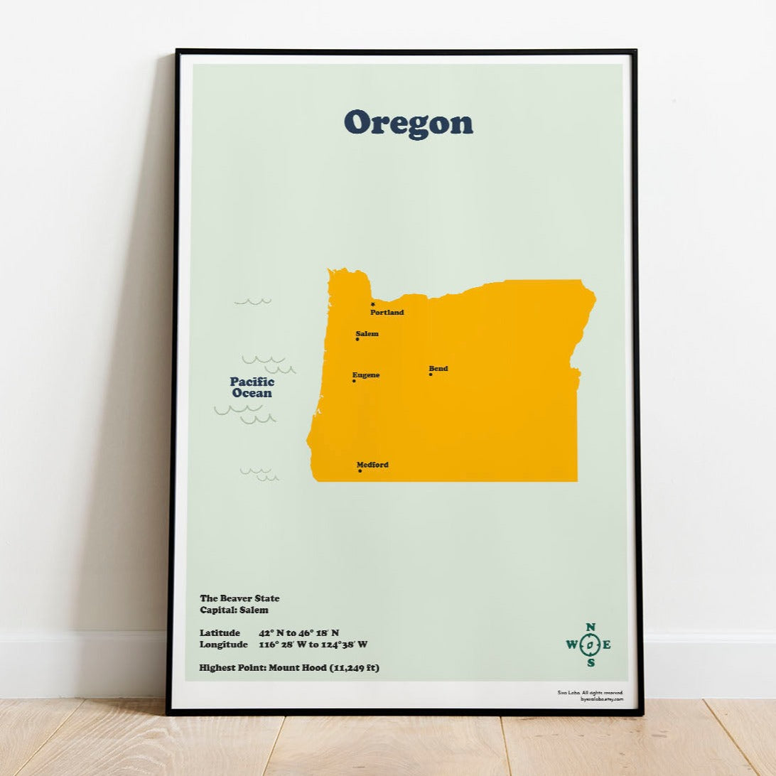
Oregon Map. Instant Download
€8,00 EUR
Reliable shipping
Flexible returns
Printable Map of the State of Oregon with the capital, latitude and longitude coordinates, the highest point in the state and the main cities.
The Download Includes:
5 JPG Files, Ready to Print and Frame
High Resolution Images (300dpi /RGB)
The 5 files are for those ratios:
+ The big standard frame: 50 x 70 cm / 20 x 28 inches
+ International ISO Size for printing up to A1
A5 (15 x 21 cm) | A4 (21 x 29.7cm) | A3 (29.7 x 42 cm) | A2 (42 x 59.4cm)| A1 (59.4 x 84.1cm)
+ 2:3 Ratio Ready to print up to 24 x 36 inches
Inches: 4 x 6 | 6 x 9 | 8 x 12 | 10 x 15 | 12 x 18 | 16 x 24 | 20 x 30 | 24 X 36
Cm: 10 x 15 | 15 x 23 | 21 x 30 | 42 x 38 | 30 x 48 | 40 x 60 | 50 x 75 | 60 x 90
+ 3:4 Ratio Ready to print up to 24 x 32 inches
Inches: 6 x 8 | 9 x 12 | 12 x 16 | 18 x 24 | 24 x 32
Cm: 15 x 20 | 23 x 30.5 | 40 x 50 | 45 x 60 | 60 x 80
+ 4:5 Ratio Ready to print up to 24 x 30 inches
Inches: 4 x 5 | 8 x 10 | 12 x 15 | 16 x 20 | 20 x 25 | 24 x 30
Cm: 10 x 12 | 20 x 25 | 28 x 35 | 40 x 50 | 50 x 64 | 60 x 75
Read more about how to print your map at home